Looks like you might be in Australia
You've landed on our NZ website, click the link below to head to the Australian site, or click out of this box if you are actually in NZ!
Visit Australian SiteStay on NZ website instead
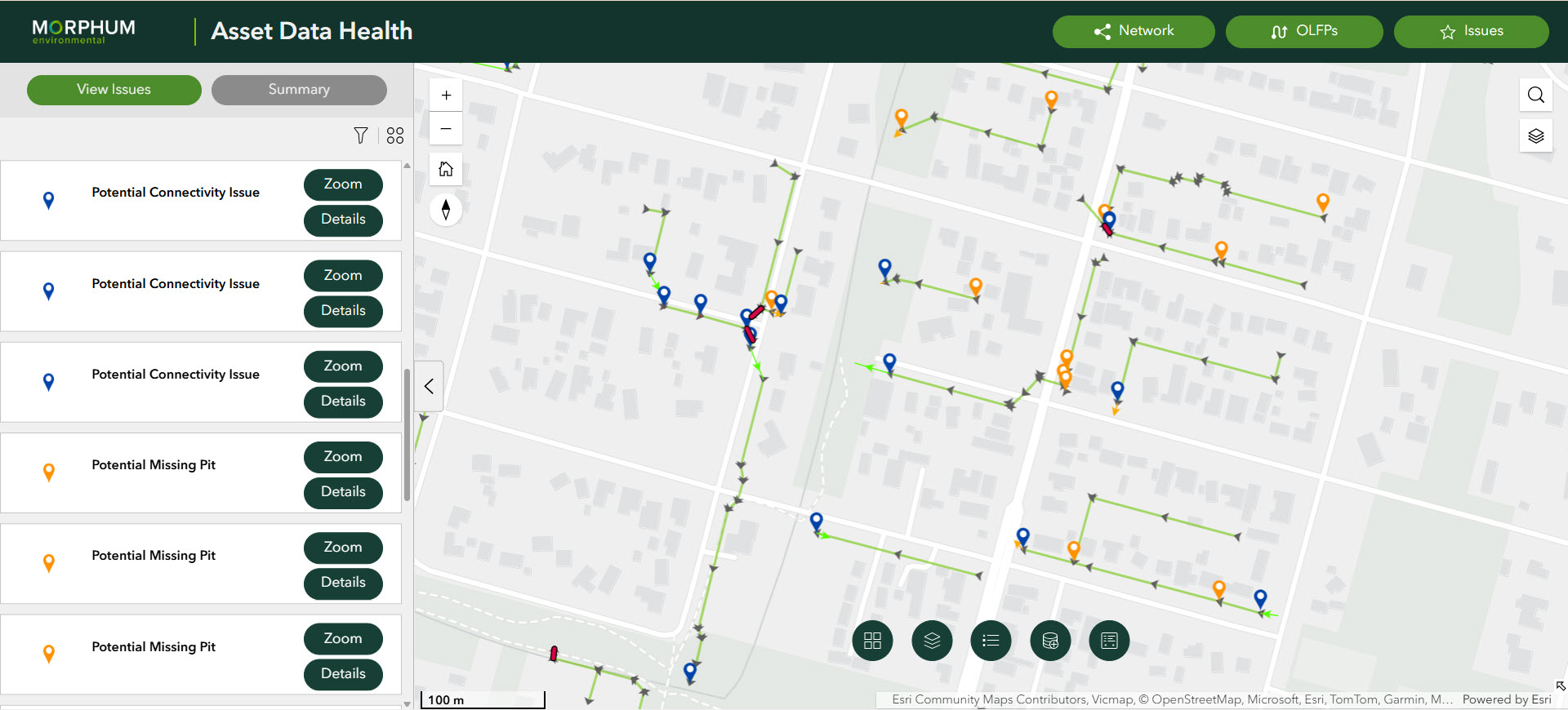

Run DHC is a smart geospatial tool that helps councils improve stormwater data to target the right actions across their utility network.
In short, it rapidly assesses drainage data to uncover gaps, improve accuracy, and identify targeted field assessments.
Good asset data is essential for infrastructure planning, and councils across Australia and New Zealand understand the importance of this data for their networks and the value that it adds to making informed decisions, but key barriers often come up that halt data improvement projects:
To address these challenges, RUN DHC has a focus on performing fast, effective analysis of the data as a first step to verifying data accuracy of infrastructure networks.
RUN DHC is built on Morphum Environmental’s Data Health Check (DHC) method, developed over more than 15 years of GIS innovation and automation to suit councils of all sizes.
It reviews stormwater asset data and finds common issues such as:
These issues can seem small, but together, they limit howwell councils can understand how water moves through the network and whereassets need priority maintenance or upgrades.
RUN DHC follows a clear process:
Step 1 - Assess the data
Our analysis tools review the drainage network and identify issues.
Step 2 - Map network problems
It shows where the network is disconnected or inconsistent.
Step 3 - Improve the network
A semi-automated approach to developing a complete stormwater network
Step 4 - Repeat and refine
The process is repeated until the network is reliable and consistent.
An accessible online platform can also be created to help teams understand their stormwater network and get ahead of potential issues.
When drainage networks are complete and connected, councils can:
Complete and connected data leads to better decisions, greater efficiencies, better environmental outcomes and more reliable infrastructure planning.
They help councils track how contaminants move through stormwater systems, improves waterway protections and helps teams and develop more effective Water Sensitive Urban Design (WSUD) solutions.
RUN DHC builds on work already completed with councils across Victoria, including:
These projects show common data issues and the value of a consistent approach to fixing them.
Many councils know their drainage data needs improvement but are unsure where to start.
RUN DHC was developed to provide that starting point, help show what is wrong, where the issues are, what to fix first, and provide your teams with the basis for how to improve the network over time.
As councils face more pressure from flooding, ageing infrastructure, and environmental requirements, accurate asset data to confidently track your utilities is critical, so let’s take that first step together.